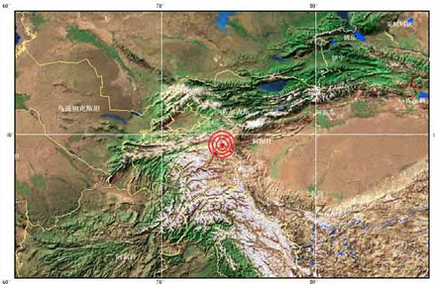
A strong earthquake measuring 6.8 degrees on the Richter scale hit Wuqia County, or Ulugqia County, in the Xinjiang Uygur Autonomous Region, northwest China, on Sunday, at 23:52 PM, according to the National Seismological Network.

The epicenter was located in Wuqia, Kizilsu Kirgiz Autonomous Prefecture, with its epicenter 110 kilometers away from the county town of Wuqia (N.39.5 and E.73.9), 180 kilometers from Kashi City, 10 kilometers from the Chinese border. The source of the earthquake was 33 kilometers underground.
Residents in Kashi also felt the strong earthquake, Xinhua reporter in Xinjiang said. There have been no reports of casualties so far.
Wuqia is located in the Pamirs, in the southwestern part of Xinjiang, and at the conjunction of the southern side of the Tianshan Mountains and the Kunlun Mountains.
Wuqia, 1,500 kilometers away from Urumqi, the regional capital of Xinjiang, was hit by a 3.8 magnitude earthquake on September 22 this year and a 5.8 magnitude quake on December 25, 2002.
(Xinhua News Agency October 6, 2008)