| Tools: Save | Print | E-mail | Most Read |
| GPS Remeasures Height of Mount Tai |
| Adjust font size: |
China has launched a survey to find out the precise height of Mount Tai (or Taishan Mountain) in east China's Shandong Province. It is the first time for Taishan to be measured with modern surveying technologies including global positioning systems (GPS), Lin Hai, an official with the Shandong Provincial Department of Land and Resources, was quoted by Xinhua News Agency as saying today. The current altitude of Taishan is known as from 1,533 to 1,545 meters, while the 1,545-meter height is the most often seen in various documents although nobody knows how or when the figure came into being. Chinese surveyors measured the mountain as 1,533 and 1,536 meters high in the 1950s and 80s respectively with simple and crude methods, which made the figures unreliable. Thirty experts arrived on Tuesday in Tai'an City to start the measurement. Modern surveying technologies will help achieve a high precision, with the range of error below two centimeters, Lin said. Meanwhile, the survey will also find out whether Yuhuangding (Jade Emperor Peak) or Guanrifeng (Sun View Peak) is the highest peak. The results of the measurement are expected to be released in October. China remeasured Mount Qomolangma (Mt. Everest)'s summit last year as 8,844.43 meters, 3.7 meters shorter than the last measured figure 30 years ago.
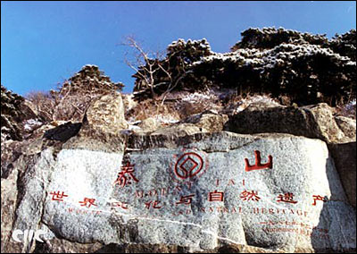
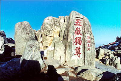
Dubbed as "the most preeminent of China's five sacred mountains," the eastern Taishan was listed by the UNESCO in 1987 as a world natural and cultural heritage for its magnificent scenery and splendid culture. The other four "sacred mountains" are the western Huashan, southern Hengshan, northern Eternity and central Songshan. A symbol of loftiness and grandeur, emperors in ancient times used to ascend Taishan to pray and say thanks to heaven and earth for peace and prosperity.
(Xinhua News Agency July 8, 2006)
|
| Tools: Save | Print | E-mail | Most Read |
 |
| Related Stories |
|
| Product Directory China Search |
Country Search Hot Buys |


